2025.03.16
1. Pressure
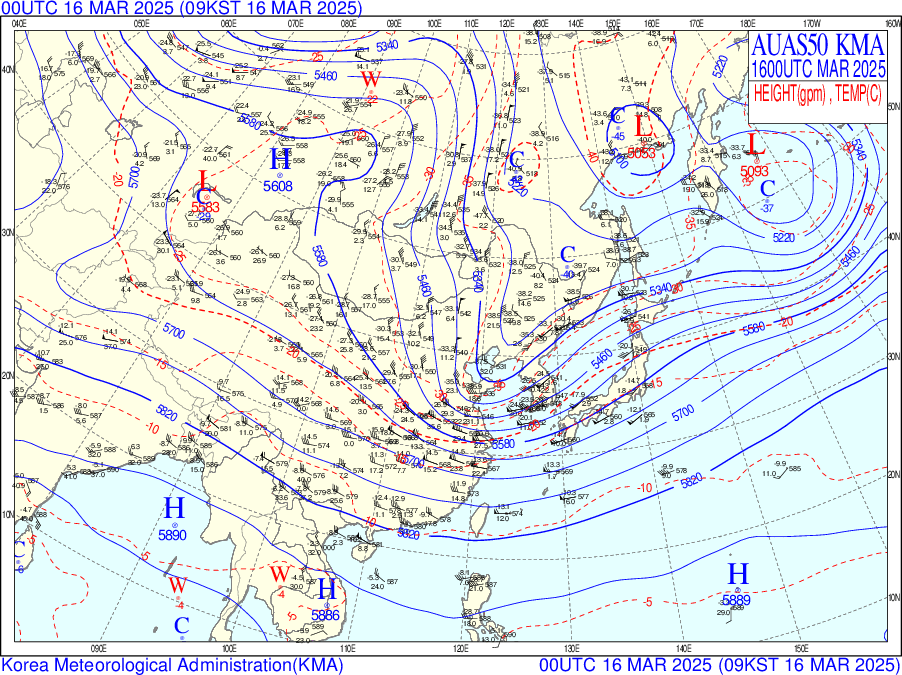
A.M. Barometer

[Surface Weather Chart]
A low-level trough is expected to affect the east coast to the central interior.
The trough will bring low temperatures, and large amounts of snow are expected to fall in the mountains of Gangwon, which are affected by the topography.
In addition, it will rain in Seoul due to the low pressure on the surface.


[700hPa Weather Chart, Humidity image]
The Korean Peninsula is a part of trough, which means that updrafts are likely to strengthen in the upper atmosphere.
In addition, the 700hpa humidity image shows a moist atmosphere over the Korean Peninsula,
and the chances of precipitation are high. Therefore, it is predicted to rain in Seoul.
[500hPa Weather Chart]
A drying trough is approaching the northwest of the Korean Peninsula.
The weather is expected to be instability, with a center below 5280 gpm and deep curvature.
Also, the isobars are oriented from north to south, indicating that cold air is moving southward.
P.M. Barometer

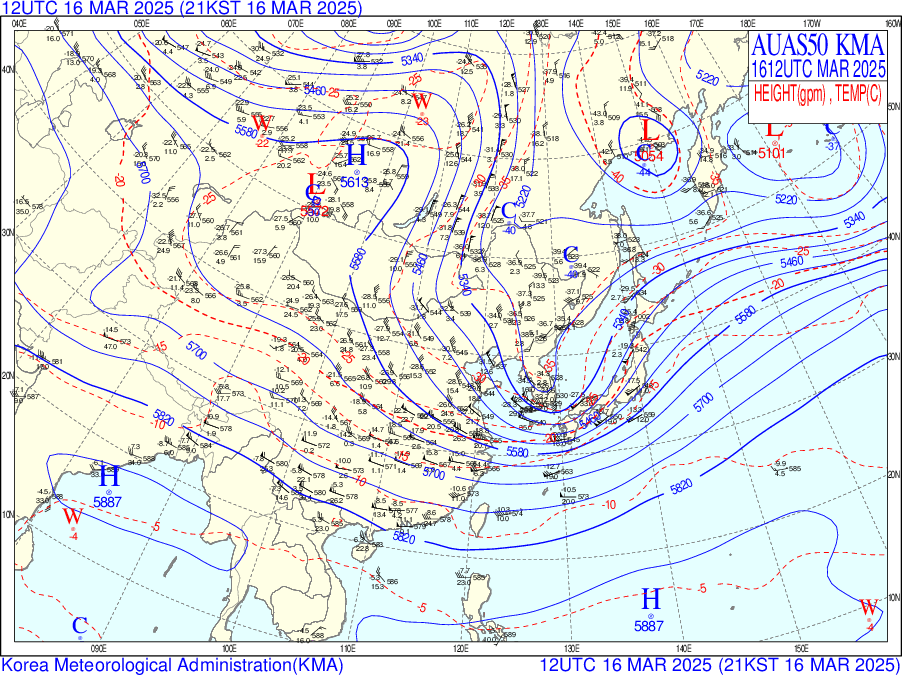
[Surface Weather Chart]
A strong low pressure system has developed over the eastern coast of the Korean Peninsula.
Located in the trough with the low pressure, the Korean Peninsula is expected to produce large amounts of precipitation and snow.
There is also a very dense isobaric distribution from the center of the low pressure to Seoul, which is expected to be accompanied by strong winds.

[700hPa Weather Chart]
The Korean Peninsula is still expected to have an unstable atmosphere with snow and precipitation due to the influence of the trough and moisture over the East Sea.
Stronger precipitation is expected over the East Sea with more moisture than the Seoul area.
[500hPa Weather Chart]
The trough moves eastward and its center will be located inland on the Korean Peninsula.
Unstable weather such as snow and rain will continue throughout the peninsula.
In addition, the range of upper-level cold air extends southward, with the -25℃ line extending southward to the vicinity of Jeju Island, resulting in lower temperatures.
At the back of the trough, upper-level northwester winds intensify,
creating a cold atmospheric structure.
2. Cloud & precipitation
[AM satellite image]


[PM satellite image]


The water vapor image shows that water vapor from the north is entering the Korean Peninsula.
In the RGB day/night composite image, clouds are distributed across the entire Korean Peninsula.
As a result, precipitation is expected over the entire Korean Peninsula, including Seoul.
Seoul has a thinner cloud layer than the east coast, so light snow and precipitation is expected.
The clouds located near Seoul will move westward and leave the Seoul area around 13:00.
[Daily precipitation]

[New snowfall(daily)]

Precipitation occurred across much of the Korean Peninsula,
with Seoul recording about 0.8mm of rainfall over the day.
3. Temperature
Minimum Temperaure

The morning minimum temperature on the 16th is predicted to be 1℃
according to the skew-t log-p diagram.
Therefore, the morning minimum temperature on March 16th is predicted to be 0.5-1.5℃.
Maximum Temperature


The maximum temperature on the afternoon of the 16th is predicted to be 7℃.
However, the 500hPa weather chart shows that a warm advection is entering the Seoul area.
Therefore, the afternoon maximum temperature on March 16th is predicted to be 9-10℃.